5. Terrain Contour Matching (TERCOM)
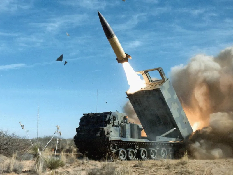
Tercom marked a major improvement in low-altitude missile navigation. This system uses stored terrain elevation data in conjunction with radar altimeter readings to ascertain the position of the missile and guide corrections. The technology lets missiles follow terrain contours to evade hostile radar systems and fly at very low altitudes. Modern TERCOM systems achieve accuracy levels before unattainable by including digital terrain elevation data and sophisticated pattern matching algorithms.
Advertisement

Recommended Reading: 25 Dog Breeds You May Find Too Dangerous For Your Home
You are viewing page 5 of this article. Please continue to page 6


Comments
Leave a Comment
Your email address will not be published. Required fields are marked *